Airteam
Airteam and Eturnity work together to combine advanced drone technology with efficient sales software. This partnership offers solar professionals great precision, simplified PV planning, and an enhanced customer experience supported by great visuals and accurate estimations.
What it means for you
- Enhanced Customer Experience: Clients receive proposals featuring photorealistic 3D designs of their actual homes, providing unparalleled realism.
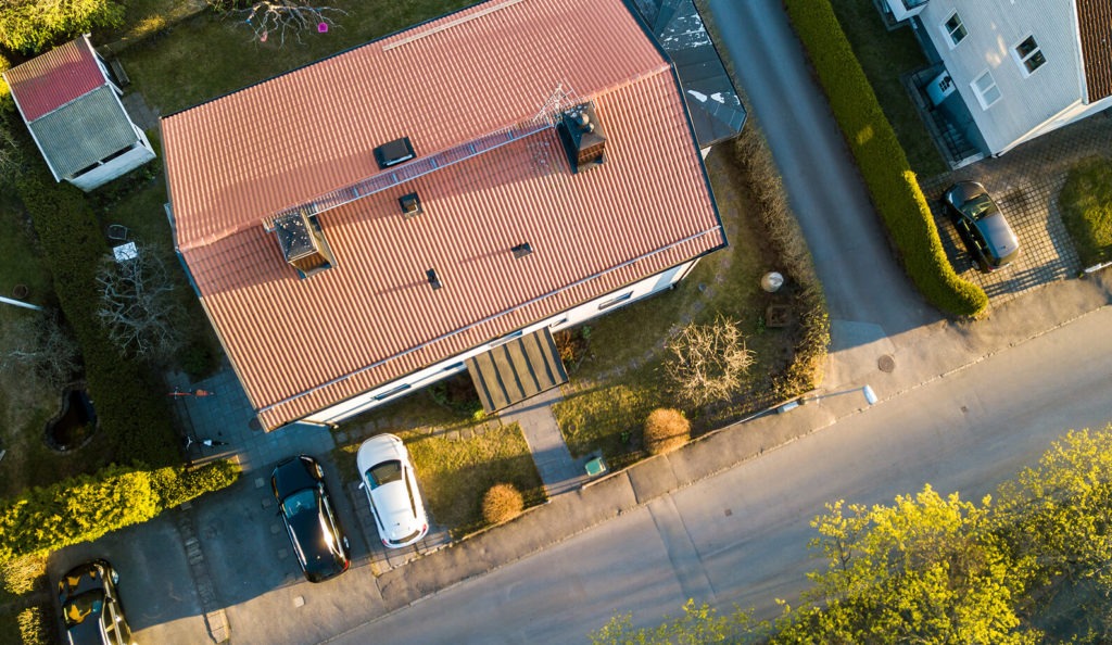
- Accelerated Site Analysis: Drones equipped with high-resolution cameras conduct comprehensive analyses in hours rather than days.
- Detailed Planning: Seamless integration of drone data into Eturnity’s software includes automatic obstacle detection, ensuring optimal solar panel placement.
- Efficient Execution: Precise data reduces project times by up to 50%, streamlining installations.
- Improved Safety: Eliminating the need for manual inspections minimizes risks and enhances team safety.
- Cost Efficiency: Significant reductions in time and labor costs increase profit margins through faster, more accurate analyses.

How it works
Airteam provides planning data for integration into Eturnity. Within Eturnity’s solar expert, the 3D models offer a precise and rapid way to create quotes for solar installations.
When creating a project on the Airteam Fusion platform, you can select “Eturnity” data as the planning data.
The Eturnity format offers a comprehensive 3D model in GLB format, including not only the roof but also the facade and surrounding area. This format is particularly well-suited for the detailed planning of solar installations for single-family and multi-family homes.
The 3D model contains all essential information, such as precise roof dimensions, roof pitch, and even obstructions like windows and chimneys.